OSM Landuse Import — Veneto
2025-03-01
Tags: openstreetmap, open-data, maps, python, geospatial
Pipeline and interactive viewer to import Veneto's 2023 land cover data into OpenStreetMap, with per-municipality .osm files and a map diff tool.
Project link: candoni.github.io/osm-import-landuse-veneto
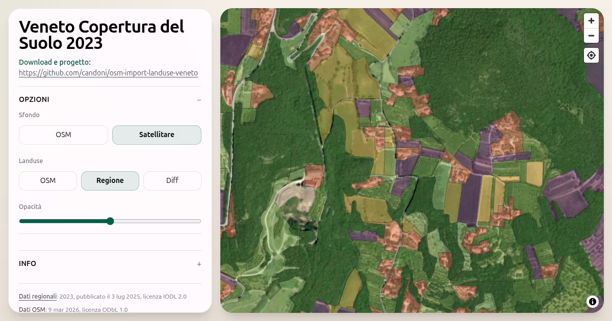
A toolchain that converts Veneto Region’s open Land Cover 2023 dataset into .osm files ready for import into OpenStreetMap — one file per municipality across all seven provinces.
The project also ships an interactive web viewer where you can browse each municipality and switch between three map layers:
- Region — land cover polygons converted to OSM tags
- OSM — existing landuse already in OpenStreetMap
- Diff — a side-by-side comparison showing matches, mismatches, and gaps
The tag mapping from regional codes to OSM conventions is fully defined in a single YAML file, making it easy to spot errors, propose corrections, or extend coverage.
The pipeline runs locally with Python, GDAL, and ogr2osm, and publishes automatically to GitHub Pages via a GitHub Actions workflow.
Data licenses: IODL 2.0 (Regione Veneto) · ODbL 1.0 (OpenStreetMap)
- Year: 2025
- Status: live